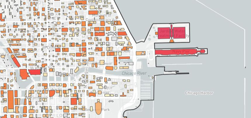
This interactive map allows you to search for specific properties or navigate the map to browse for any property within the City of Chicago and a limited area of suburban Cook County. This tool provides reliable estimates of the solar energy production potential for all buildings and land parcels within this geographic area.
The map allows you to filter by property type, solar potential, and neighborhood. It also provides searchable filters to indicate whether the property is within the Illinois Solar for All low-income and environmental justice community boundaries – properties in these areas may qualify for higher solar incentives through this important Illinois program.
Methodology
Methodology for Determining Solar Energy Production
The Chicago Solar Map uses Light Detection and Ranging (LiDAR) data combined with the National Solar Radiation Database (NSRDB) from the National Renewable Energy Laboratory (NREL) to estimate both solar capacity in kilowatts (kW) and electricity generation in kilowatt hours (kWh). Both capacity and generation are estimates. Actual values for your property may vary based on rooftop obstructions, local building codes, and other factors. Properties with less than 1 kW of capacity are not shown on the map. Because vacant land parcels were not included in the LiDAR dataset, capacity is estimated for these parcels based on square footage.
For more information on how NREL estimates solar potential, visit the NREL website.
Illinois Solar for All Environmental Justice Communities
This map uses Illinois Solar for All (ILSFA) data as determined by the ILSFA program. Environmental justice communities may face disproportionate harms associated with pollution and may be less equipped to deal with these harms than other communities. As such, ILSFA prioritizes the distribution of incentives to these communities. The Illinois Power Agency outlines the methodology for designating communities as environmental justice communities in section 8.15 of the Long Term Renewable Resources Procurement Plan.
For more information on ILSFA environmental justice communities or to apply for self-designation of your community, visit the ILSFA website.
Illinois Solar for All Low-Income Communities
This map also shows low-income communities as defined by ILSFA. Census tracts where at least half of the population earn 80% or less of area-median income qualify as low-income under ILSFA. ILSFA prioritizes the distribution of incentives to these communities in addition to environmental justice communities.
To learn more about ILSFA and how to qualify, visit the ILSFA website.
Property Type Data Source
The property classifications for the Property Type map filter come from 2020 Cook County Assessor data. A list of the property types found within the dataset can be found here.
Citations
- The National Renewable Energy Laboratory (NREL), 2017.
- Data generated by the National Renewable Energy Laboratory (NREL) from LiDAR data provided by the U.S. Department of Homeland Security, Homeland Security Infrastructure Program.

